From December 2012 to January 2013, Jason Florio and Helen Jones-Florio co-led the first recorded source-to-sea expedition by canoe along the 1130 km length of River Gambia. The two traced the river from its humble source in the remote highlands of Guinea through Senegal and into The Gambia, where it widens to nearly 14 km and exits into the Atlantic Ocean.
Jason and Helen teamed up two old Gambian friends — Abdou Ndong, a fisherman, and Ebou Jarju, a school teacher — as our river guides and translators. Their photography offers a rare insight into the unique journey.
River Gambia is one of the major arteries into West Africa from the Atlantic Ocean. It was first penetrated in 1455 by Portuguese explorers then fought over by the French and British. Scottish explorer Mungo Park travelled up it on both his attempts to seek the course of the River Niger. Slave traders sailed their human cargo down to the estuary for the trans-Atlantic slave trade, adventurers pushed far into the interior of what is modern-day Senegal in search of gold, and huge barges continue to course the navigable reaches to the old Gambian colonial-era towns to collect hauls of peanuts.
Fishermen still throw nets from precarious narrow pirogues throughout much of the course of the river, and Guinea-Bissau refugees scour the mangroves for oysters in the brackish tributaries. Economic migrants flock to the Senegal sections of the river, busily washing the gold-bearing river sand as they have done for hundreds of years.
It was the British, who, in 1889, ultimately took control of 338 km of River Gambia from the Atlantic coast eastward, thereby creating the smallest country on the continent of Africa. This is what is now The Republic of The Gambia. Once we started researching for the expedition, we discovered plans were afoot to create a hydroelectric dam on the river at the Guinea-Senegal border. Villages would be flooded, and the natural seasonal rise and fall of the river would be choked, causing a potentially devastating effect on the environment and the people. The idea of making the journey became a matter of urgency so as to create a modern-day account of the communities living along the banks of one of Africa’s last major free-flowing rivers — before irreparable damage was done.
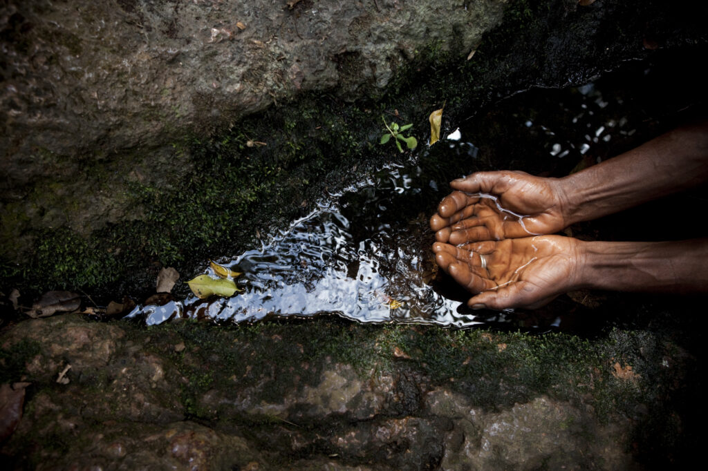
The source of River Gambia emerges from under a rock in the Fouta Djallon Highlands of Guinea. From this point, the river meanders for 1130 km through Guinea, Senegal, and The Gambia. Before entering the Atlantic Ocean near Banjul, this small pool grows to more than 14 km wide. Gaspard Mollien, a French explorer who clandestinely visited the river’s source in 1818 (he risked being killed by locals who protected the sacred spot), was the first European to lay eyes on the spring. Nowadays, a traveller can safely enjoy the still-protected spot, after giving the local chief a few kola nuts as a traditional gift.
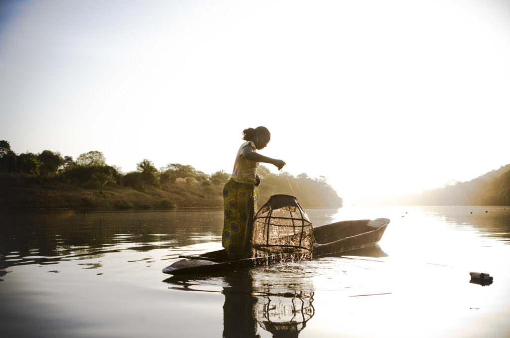
It is dawn on the River Gambia near the village of Fatoto, a small town in eastern Gambia, Upper River Region. As we paddled along in two canoes with our Gambian companions, Abdou and Ebou, we came across this migrant fisherwoman from Mali checking her fishing pots.
Many of the women we encountered fishing on the river were seasonal migrants from Mali, Guinea, and Senegal This was a regular sight in the early mornings and evenings.
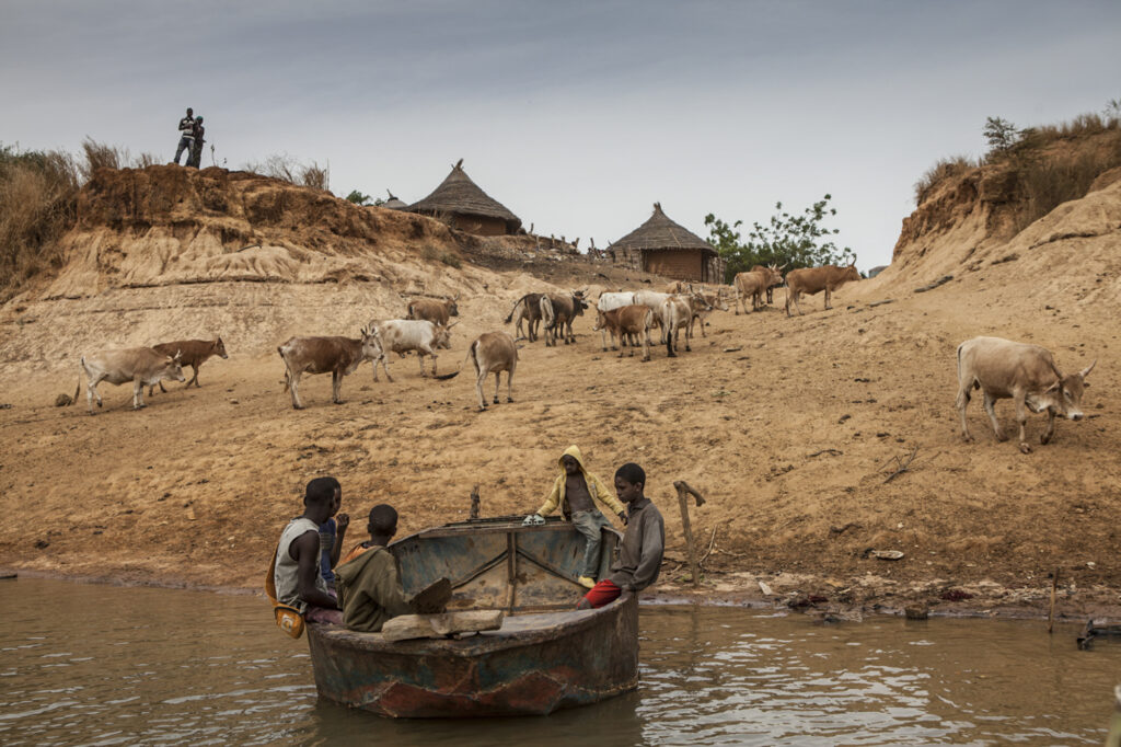
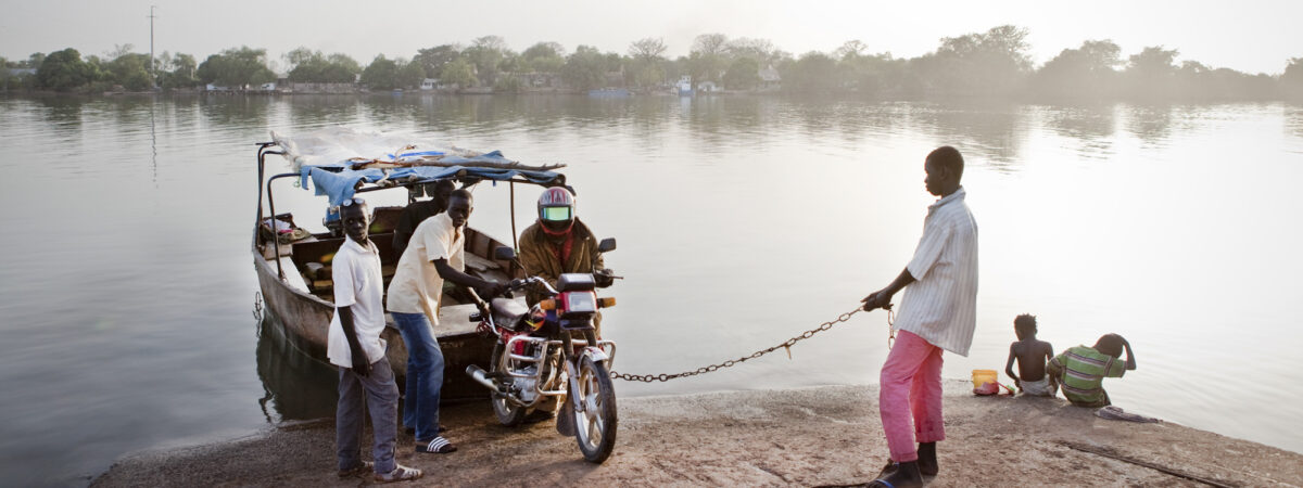
A community ferry called a barra (basic boats, made of welded metal sheets) transports boys to the north bank of River Gambia at the village of Fatta Tenda. For centuries, the river was a busy transportation route. Since the construction of bridges, however, many of the country’s goods travel by road. Not all communities have stopped plying The Gambia’s waters, though. In the upper river regions, barras are still used by locals.
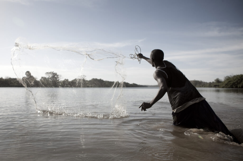
Mr. Seeso, the alkalo (village chief) of Karantaba Tenda, a small town in northeastern Gambia, throws his fishing net into the River Gambia. Karantaba Tenda was where Scottish explorer Mungo Park set out on one of two epic journeys that he made in search of the Niger River more than 200 years ago. Deep in the overgrown bush, outside of the town, stands a memorial to Park, erected by the Royal Scottish Geographical Society.
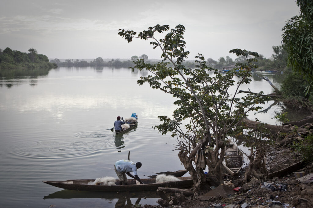
It is early evening as fishermen head out with the tide in their dugout canoes piled with fishing nets. They push off from the banks of the riverside town of Bansang in Central River Division for a night of fishing.
The fishermen often stay out all night in the fishing grounds and return home using the tides.
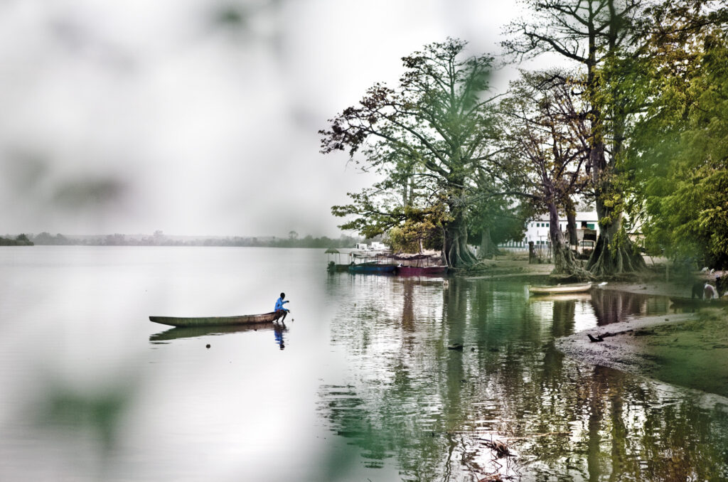
A young schoolboy, Samba, paddles out in his family’s pirogue (dugout canoe) to check his catch of the day in Kuntaur, Central River Region of The Gambia.
He told us that, in the early hours of each day, before going to school, he paddles out and drops the fishing net. For such a small boy, Samba paddled the heavy canoe with ease and dexterity, as if it were a little rubber dingy.
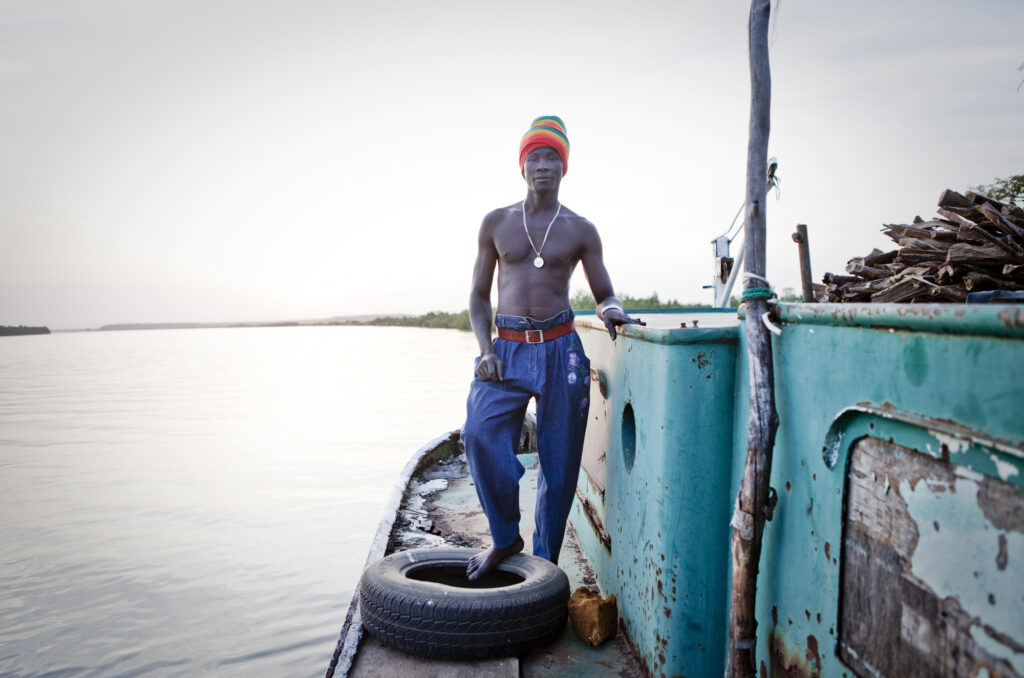
Lopiz Jarju is one of the few full-time sailors still working on River Gambia. He works for the Gambia Groundnut Corporation on one of its tugboats, which pulls barges with 100-tonne loads of peanuts from upcountry loading centres on the banks of River Gambia to a processing plant where the river meets the Atlantic Ocean at the capital, Banjul.
When we met Lopiz, his tugboat had been broken down for a few weeks and was moored in Kaur, West Coast Region, waiting for spare parts to arrive. That evening, he cooked us dinner on an open fire — a well-known Gambian dish called fish yassa.
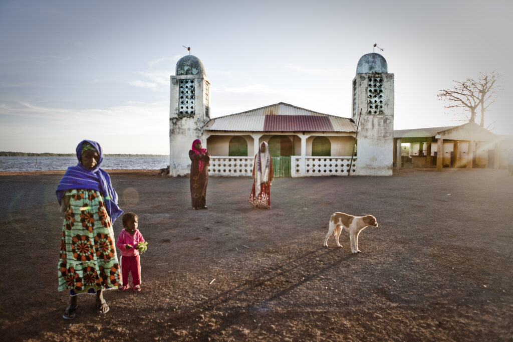
It’s another early morning on the banks of the River Gambia, this time in Tendaba, Lower River Region. Neighbouring women, one with her grandchild, take a stroll by the village mosque to greet each other.
In the background, beside the mosque, is the local fish market. Tendaba is also well-known for Tendaba Camp, one of the oldest tourist camps in The Gambia.
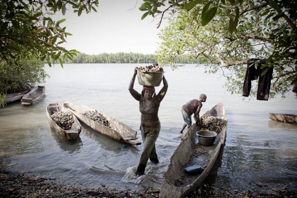
Female migrants from Guinea Bissau on a tributary of the River Gambia, in Brefet, Lower River Region, unload extremely heavy buckets of oysters. It is tough, laborious work, and the women spend hours amongst the mangroves in dugout canoes, cutting the oysters found hanging from their sinewy, tentacle-like branches.
Many of the women will not head back to their riverside camp until their canoes are fully loaded with oysters. The oyster season is only a few short months, and the women must maximise their yield to support their families.
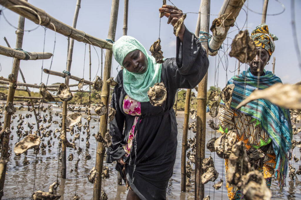
In the brackish stretches of the river where the mangroves have suffered from the firewood hunter’s axe, the women who collect the oysters have also become guardians of this tree. The mangroves are not just essential to their livelihood, but they are vital for a healthy river ecosystem. To prevent over-harvesting, and to reduce pressure on the mangroves, the women have also created oyster farms near their Tenda (wharf). The farms also enable older women, who can no longer do the hard work of paddling canoes and hacking razor-sharp oysters from the mangroves, to remain productive members of society.
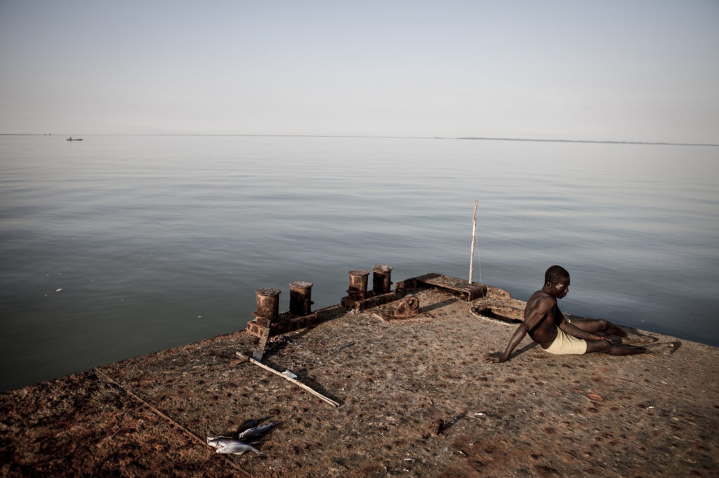
A lone fisherman sits on the edge of Bonto Pier at the mouth of River Gambia. At this point, the river has expanded from a humble trickle in the Fouta Djallon Highlands of Guinea to a massive 13 km wide.
The mangroves that flank the mouth of the river in this area are an essential part of the river’s ecosystem: They provide a spawning ground for fish and create economic opportunities for local women who collect oysters that grow on their branches. Mangroves, like other coastal wetlands, are powerful carbon sinks. They suck up carbon dioxide from the air to store in their roots and branches, as well as the sediment that collects around them, and store up to 10 times more carbon than forests. The preservation of the Gambian mangroves are now a focus for Gambian and international environmentalists, with locals including the oyster women playing important roles in their conservation.

